# GeoIntel

Evidence-first geospatial analysis for Belgium and the Belgian North Sea.
Workbench · Capabilities · Quick start · Architecture
GeoIntel combines official geospatial sources, map-based analysis, computer vision, QA/QC and reproducible exports. A saved result carries its source, spatial context, model revision and review evidence. The application covers Belgium and the legally distinct Belgian North Sea zones without hiding differences between regional source datasets.
Mol and the Kempen remain golden regression areas for the Belgium-wide workbench; they do not limit its geographic scope.

## Explore the workbench
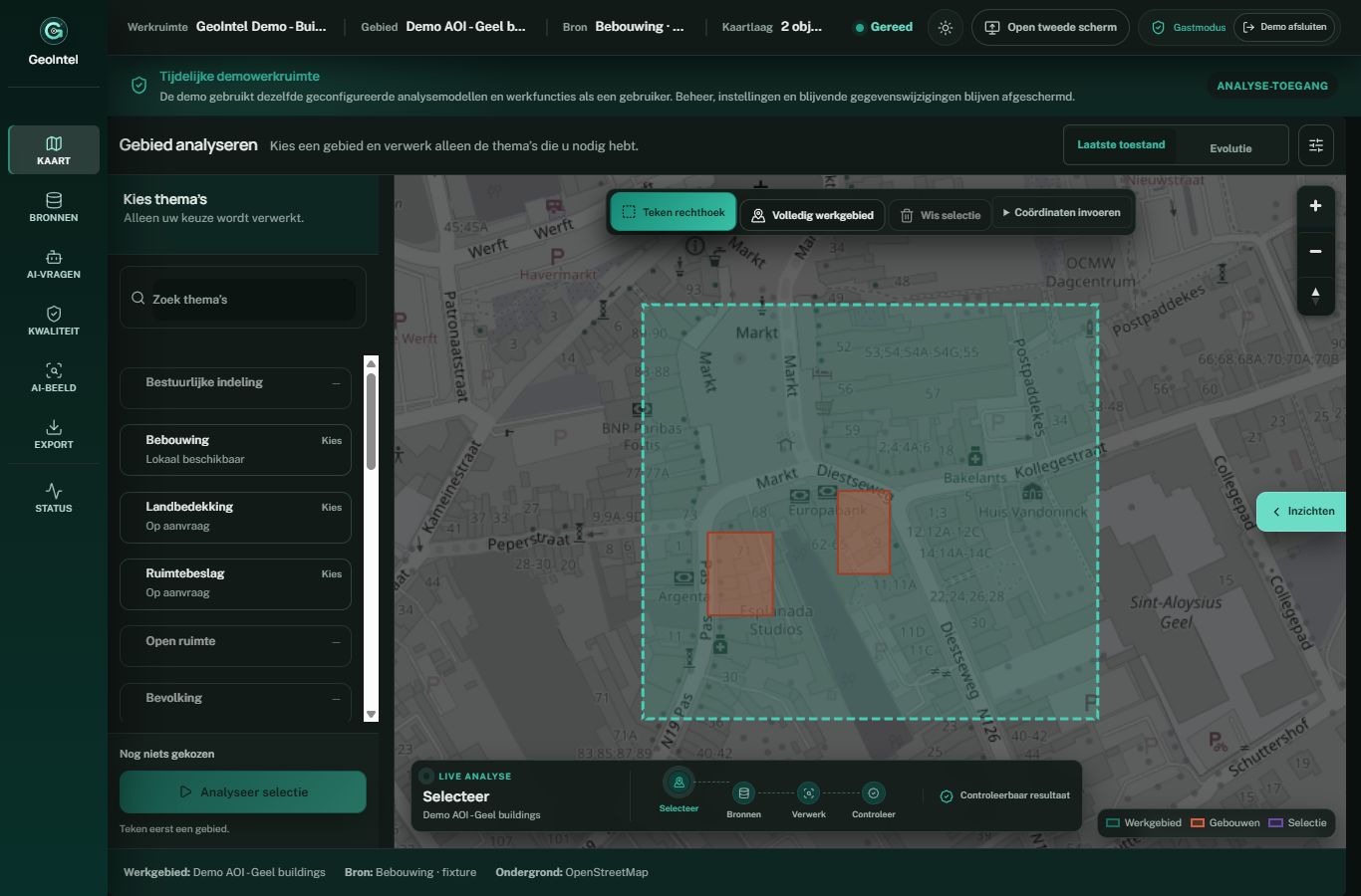
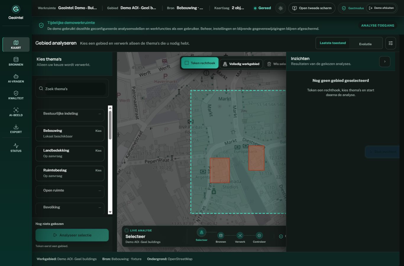
The following captures use public or synthetic demonstration content. Select an official boundary or draw an area of interest, choose compatible layers, run an analysis, inspect object-level evidence, and export the reviewed result.
| Map workbench | Quality review |
| --- | --- |
|  |  |
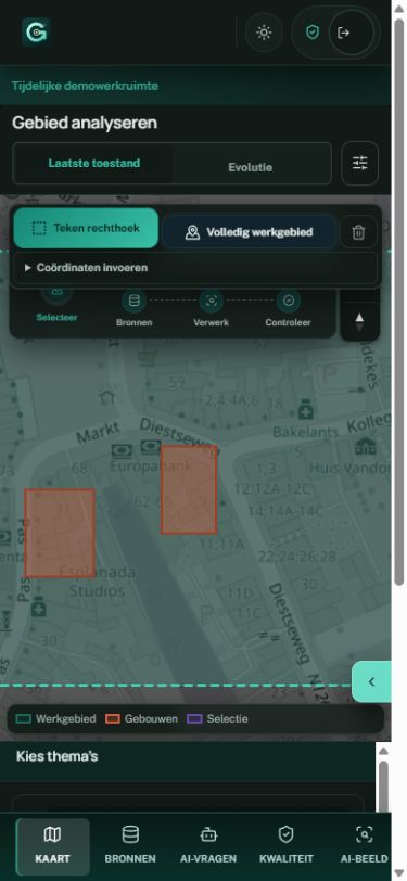
The mobile workbench keeps the same analysis context on a narrow screen. [Asset provenance](docs/ASSET_PROVENANCE.md) describes these captures and project artwork.
## What it does
- **Source-aware mapping:** official boundaries, vector and raster layers, orthophotos, regional and maritime sources, and explicit coverage.
- **Spatial analysis:** coordinate-system normalization, clipping, buffering, joins and raster statistics.
- **Governed GeoAI:** PyTorch, YOLO and SAM-compatible model workflows with immutable revisions and release gates.
- **Quality before publication:** precision, recall, F1, IoU, false-positive and false-negative evidence, plus human review.
- **Traceable output:** reproducible GeoJSON and artifacts linked to the selected area, input versions and model revision.
Model detections are reviewable proposal evidence until the relevant release gate passes. Official footprints are not assumed to be perfect image labels; temporal validity and spatial leakage are checked during training and calibration.
## Quick start
Requirements: Docker Engine with Compose. From the repository root:
```bash
docker compose up --build
```
Open . The development stack uses Python 3.11+, Node 20.19+ or 22.12+, and PostgreSQL/PostGIS. Set `GEOINTEL_AUTH_ENABLED=true` and explicitly opt in with `GEOINTEL_GUEST_ACCESS_ENABLED=true` only for a dedicated public-data demo. Guest sessions are short-lived and project-bound; administration and uploads remain restricted.
## Work through an area of interest
Begin with a small area, select the appropriate source coverage and inspect acquisition dates, coordinate reference systems and quality indicators. Compare the source layers before running an optional model. Review the result against the input evidence, then export the geometry with its provenance.
Do not treat missing coverage as an empty real-world scene. Building footprints and roof geometry answer different questions, and results from different dates may not be directly comparable. An inference workflow needs the configured model artifacts and supported runtime in addition to a working map interface.
## Technical overview
```mermaid
flowchart LR
Web[React, TypeScript and MapLibre] --> API[FastAPI]
API --> GIS[GeoPandas, Shapely and Rasterio]
API --> Jobs[PostgreSQL job queue]
Jobs --> AI[PyTorch inference]
GIS --> DB[(PostgreSQL and PostGIS)]
AI --> DB
DB --> QA[QA and provenance]
QA --> Web
```
Configured AI inference can use NVIDIA/CUDA and fails closed when a required accelerator is unavailable. A deployment needs persistent PostGIS and artifact storage, authentication, HTTPS, health checks, backups and a tested restore path. Do not place private model weights, credentials or operational exports in this repository.
For source checks, run `python -m compileall backend/app`, the backend pytest suite, and the frontend typecheck, unit tests and build. `backend/` contains the API and spatial workflows; `frontend/` contains the UI; `contracts/` contains shared interfaces; `fixtures/` contains safe examples.
## Public-source provenance
This is a reviewed content-only export from a private canonical repository. `PUBLIC_SOURCE_MANIFEST.json` records the source revision and hashes; private Git history is absent. GeoIntel is licensed under [Apache 2.0](LICENSE). See [SECURITY.md](SECURITY.md) for vulnerability reporting.